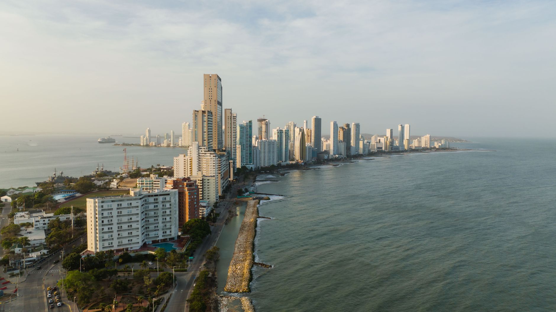
Cartagena's shoreline is not a fixed line, and along parts of the northern coast the retreat is documented by the authorities. This article does not say whether Castillogrande is at risk: it says who has measured it and how to ask them.
Erosion matters to a purchase along three concrete, checkable lines. The first is the rule: the POT may classify a polygon as protected land or a hazard zone, which limits what a curaduría can permit on it, now and in any future extension. The second is the works: where retreat occurs you find groynes, breakwaters and fill — permitted works, with an owner and a maintenance burden, and it is worth knowing whose. The third is the boundary with public domain: if the sea advances, the zona de bajamar moves with it, and the property's relationship to that strip is not what it was. None of this is settled by opining about the future; it is settled by requesting the document.
In Castillogrande the typical deal is not a unit in a condominium but a house and its lot, which puts the weight of the file back on the chain of title to the land: you climb through the deeds to the parcelación, the original subdivision that created the block, because those platting deeds registered conditions, setbacks and easements that still bind and that are invisible from the street. There is no building manager to issue a paz y salvo, a no-arrears certificate, and no assembly to settle anything, so boundary questions with a neighbor are argued between private parties and what governs is the title and the survey, not a set of house rules. The counterparty is usually an old city family and, fairly often, a family company that owns the property: then you must decide whether to buy the real estate or the company's shares, two different transactions with different paperwork and different exposure, and request the certificado de existencia y representación, the corporate good-standing and signing-authority certificate, together with the resolution approving the sale. And because the neighborhood is fully built out, any construction is permitted on an already developed lot, with neighbors entitled to take part in the proceeding.
What is specific to Castillogrande
The residential tip of the peninsula: lower and quieter than Bocagrande, facing the bay, with little street retail. Houses and low-rise buildings sit alongside new towers, and single-family homes still exist. It is a dead end: access is through Bocagrande with no through road at the far tip, which keeps it free of passing traffic.
- whether the property faces the bay or the open sea, because the swell, the smell and the façade upkeep are not comparable
- what building height the rules allow on the lot, which is not uniform across the peninsula and is the first fact omitted when a lot is sold
- how ground stability was addressed, given this is land reclaimed from the sea, and what the soil study for the building says
What to verify, step by step
- Ask DIMAR what information it holds on shoreline behaviour along the Castillogrande stretch and whether protective works are authorised there. It is the body that oversees the coast.
- Request from Cardique the studies and administrative acts on erosion and coastal protection applying to that stretch, as the environmental authority for the jurisdiction.
- Check the POT for whether the property falls in protected land, a hazard zone, or under a setback from the sea, and request the polygon's normative sheet in writing.
- Ask the curaduría exactly what the permit for the property or the seafront project authorises, and whether it was conditioned on a setback or on protective works.
- In a condominium, ask the administrator for the history of works on the beachfront and the minutes where they were debated: that is where you see who has paid for what.
- Request the building's soil study and confirm it exists and is signed, rather than asking whether the building is safe.
Mistakes that cost money
- Asking the seller whether there is erosion and leaving it there. The question goes to the authority and is put in writing, because the answer has to be something you can keep on file.
- Reading the state of the beach on the day of the visit as the permanent state of the coast. Beaches shift with the season and with neighbouring works; the document is what persists.
- Buying on the front row without reading the polygon's normative sheet. The setback from the sea governs what may be built and rebuilt, and it is a POT fact, not a brochure one.
Frequently asked questions
- Can you tell me whether this particular apartment is at risk?
- Not from an article, and not from a sales office either. DIMAR and Cardique hold the information for the stretch, and the POT sets the land classification. What we do here is tell you whom to ask.
- Do protective works solve the problem?
- They are works that exist, require permits and require upkeep. What is verifiable is whether they are authorised, who is answerable for them, and who funds their maintenance — the last of which shows up in the building's minutes.
- Are there sectors with documented erosion?
- Yes. In Punta Canoa coastal erosion risk is documented along the stretch, which is why it forms part of the routine check there. For Castillogrande the enquiry is made the same way, through the same channel.
Where to check it
- Dirección General Marítima (DIMAR) — public-domain tidal land and concessions over the beach
- Cardique, autoridad ambiental del Canal del Dique — environmental permits, water setbacks and mangrove or wetland constraints
- Plan de Ordenamiento Territorial de Cartagena — land use, the rules applying to the property and protected land
- Curadurías Urbanas de Cartagena — whether a current building or subdivision permit exists and exactly what it authorises
- Instituto Geográfico Agustín Codazzi — the cadastral record, area, boundaries and assessed value of the property
- Alcaldía Mayor de Cartagena de Indias — property tax, betterment levies and District procedures
- Cartagena de Indias — the rules of the municipality Castillogrande belongs to
Official bodies. Specific figures are requested there, not copied from a listing.
Updated 2026-11-05
More about Castillogrande
- Mangrove, ronda hídrica and wetland in Castillogrande: why a protected lot does not develop like the rest
- Maintaining a seafront property in Castillogrande: what to ask the building manager before signing
- Beachfront apartment in Castillogrande: what changes versus being a few blocks back
- Penthouse and terrace in Castillogrande: what is yours and what is common property assigned for exclusive use
- House in a gated community in Castillogrande: what you are actually buying
The same, in other neighbourhoods
- Coastal erosion in Crespo: where the data lives and what it means for building on the front row
- Coastal erosion in El Laguito: where the data lives and what it means for building on the front row
- Coastal erosion in Barceloneta: where the data lives and what it means for building on the front row
- Coastal erosion in La Boquilla: where the data lives and what it means for building on the front row
Interested in a property in this area?
Write to us and we will send you the available options.